US weather: Deadly 100mph Santa-Ana winds to raise wildfire risk to ‘critical’
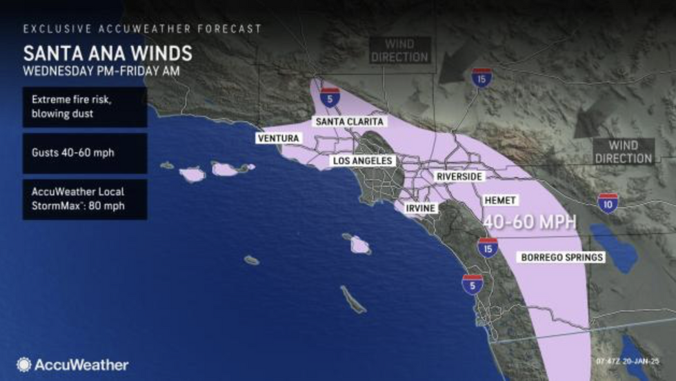
A fresh round of deadly 100mph Santa-Ana winds will hit western states, raising America’s wildfire threat back to ‘critical’.
As much of the country freezes in a minus-20C snow blast, warm, dry winds along the Pacific coast threaten ‘rapid fire spread and extreme fire behaviour’.
The warning comes as California firefighters battle to contain some of the worst wildfires on record.
But as the flames are brought under control, the region is bracing for another round of incendiary winds.

A spokesman for the US National Weather Service (NOAA) said: “Conditions will begin to warm for the western US into the middle of the week, and the continued dry conditions and dangerous Santa Ana winds will contribute to Extremely Critical fire weather conditions for southern California.
“Coastal winds could gust into the 50mph to 70mph range, while wind gusts near 100mph will be possible in the mountains and foothills.
“Conditions will remain dangerous with additional rounds of gusty offshore winds, and if fire ignition occurs, conditions are favourable for rapid fire spread and extreme fire behaviour.”
National ‘Red Flag’ fire warnings have been re-issued in California stating ‘critical fire weather conditions are either occurring now….or will shortly’.
US LATEST:
- Trump is told to ‘have mercy’ on trans people and migrants by woke bishop in toe-curling lecture
- Trump fires Coast Guard chief for ‘excessively focusing on DEI’ instead of ‘border security’
- Donald Trump set to sign executive orders on stage after being sworn in as 47th President

A NOAA spokesman added: “A Fire Weather Watch means that critical fire weather conditions are forecast to occur.
“A combination of strong winds, low relative humidity, and warm temperatures can contribute to extreme fire behaviour.”
Jim Dale, US meteorologist for British Weather Services and co-author of ‘Surviving Extreme Weather’, said: “Away from the cold weather to the west, there are going to be further Santa-Ana winds, and this will bring back the risk of wildfires.
“These are winds that dry and warm as they travel from high ground across regions with low humidity, and so with that, there will be an ongoing risk of fresh outbreaks this week.”
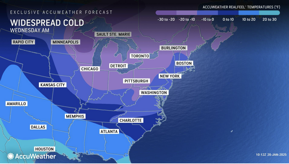
Meanwhile, the rest of the United States is braced for a minus 20C mega-freeze as a swath of freezing Polar air swoops down from Canada.
Heavy snow through the week and into the weekend threatens chaos on roads and travel networks.

The combination of big freeze and wildfires will unleash a double-whammy of ‘dangerous’ weather.
AccuWeather meteorologist Jonathan Porter said: “This is a week of high-impact and dangerous weather from coast to coast.
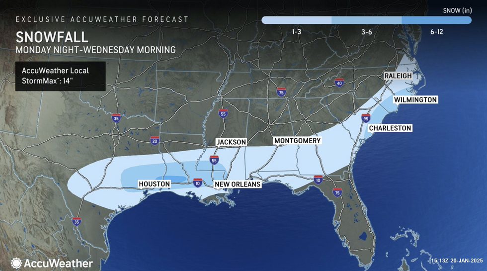
“A rare winter storm will bring significant snow and ice accumulations to parts of the South that haven’t experienced weather like this in years, or even decades.
“Southern California is dealing with another dangerous Santa Ana wind setup, and the combination of major fires still smouldering, exceptionally dry conditions and winds gusting above 60 mph is incredibly concerning.
“Any fire that sparks could spread rapidly and be nearly impossible to contain.”
The coldest snap of the season could bring record low temperatures to the Plains and eastern States.
Severe cold weather in Washington DC at the start of the week forced the indoor inauguration of America’s new President.
Weather Channel meteorologist Robb Ellis said: “An Arctic air mass will invade the Plains and East early this week causing temperatures to plunge far below average.
“Several records could be set as the coldest air of the season so far settles in.”

