
US weather: California to be hit with five feet of snow as tropical moisture crashes into Arctic air
A rain-laden ‘vapour surge’ charging in from the Pacific threatens torrential downpours and up to five feet of snow.
Western states face a relentless deluge through the start of February as warnings emerge for disruption and flooding.
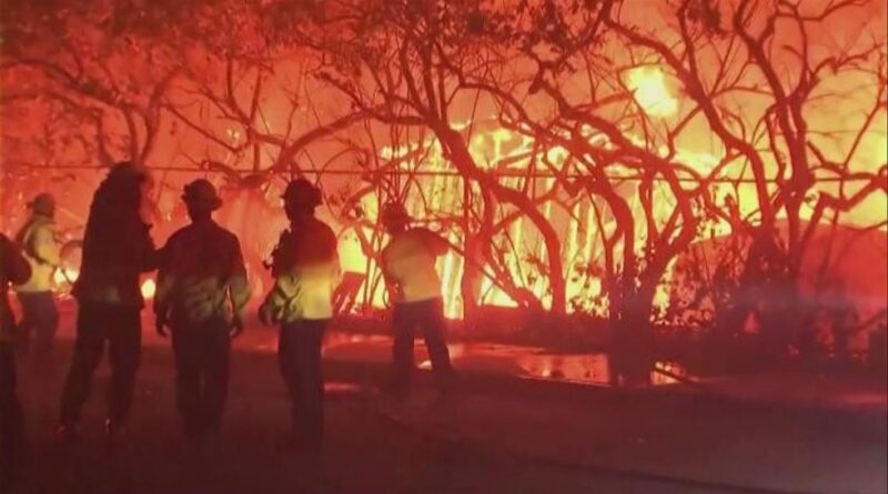
Worst hit will be California, still reeling from devastating wildfires dubbed some of the worst in the state’s history.
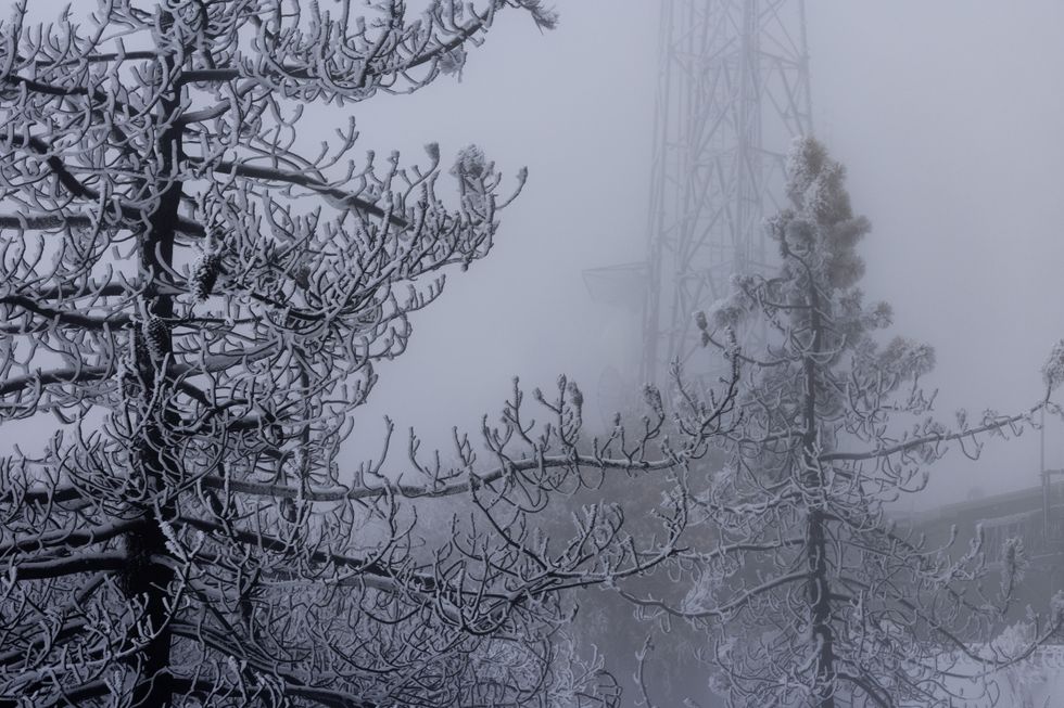
But where tropical moisture carried by the ‘atmospheric river’ hits Arctic air, communities are braced for hulking snowdrifts.
AccuWeather meteorologist Bernie Rayno said: “This atmospheric river will unleash the most rainfall Northern California has seen so far this year.
“Rounds of intense rain could trigger landslides and rockslides, and as this is tropical moisture with warmer air, snow levels will be much higher than we typically see.
“The heavy rain could melt some of the snowpack in the lower elevations, which could contribute to flooding problems.”
Also known as a ‘Pineapple Express’ or ‘vapour surge’, the atmospheric river will pull plumes of water into the west coast.
Hours of relentless rainfall into mid-week threatens flooding, mudslides and debris flow across regions recovering from wildfires.
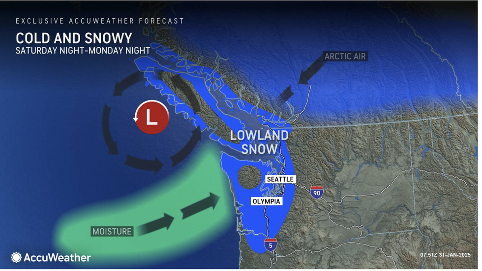
Up to two inches of rain will douse Washington and Oregon while feet of snow blanket the mountains.
LATEST DEVELOPMENTS:
- ‘Roller-coaster’ of temperatures to hit US as ‘weather whiplash’ sparks cold front after ‘warm rush’
- US weather: America set to be battered by violent thunderstorms, tornadoes and ‘snow squalls’
- ‘Toxic floods’ to hit land ‘scarred’ from wildfires as cyclone threatens mudslides and flash floods
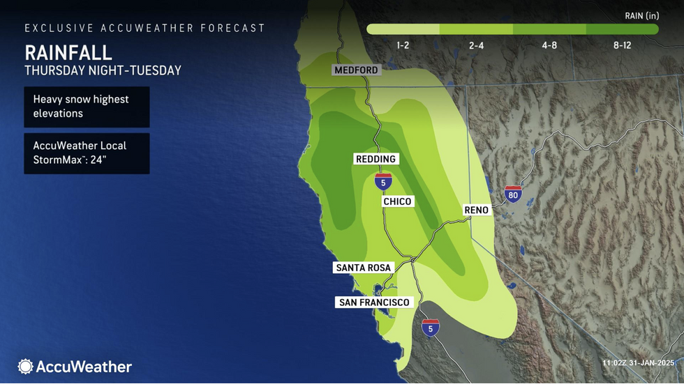
Mr Rayno said: “Atmospheric rivers can transport tremendous amounts of moisture, and there could be up to two feet of rainfall in the coastal ranges and western slopes of the northern Sierra.
“Snowflakes are possible in the major cities of Portland and Seattle as temperatures fall on Saturday night, and there is even the potential for Seattle to get some accumulating snow.”
AccuWeather’s Dave Houk added: “There could be periods of rain Tuesday night into Wednesday in the Los Angeles area.
“If there are several hours of heavy rain, there would be an increased risk of debris flows and mudslides in recent burn scar areas.”
As the Pineapple Express sweeps through, California will swap the misery of wildfires for floods and blizzards.
Jim Dale, US meteorologist for British Weather Services and co-author of ‘Surviving Extreme Weather’, said: “The Pineapple Express is on its way, and it is carrying a lot of cargo.
“It has the potential to swap wildfires for floods and blizzards as it moves into California, and there will be very heavy rainfall associated with this system.
“Over the mountains, there is the potential for heavy snow fall and some accumulations.”
The US National Weather Service (NOAA) warned that in parts up to two feet of snow is possible.
Up to eight inches of rain and milting snow flowing over ‘burn-scarred’ wildfire sites will raise the flood risk, it warned.
A spokesman said: “Some of this very heavy snow over the Northwest will also be influenced by a strong atmospheric river impacting northern California which is forecast to bring very heavy rainfall totals into the coastal ranges and the interior foothills and upslope areas of the northern Sierra Nevada.
“Additional four to eight inches of rain can be expected locally, with isolated heavier totals, and flooding will become a notable concern across these areas.”