
US weather: Violent tornadoes to wreck havoc as relentless storms will plough into Arctic mega-freeze with blistering -45C North Pole winds
Relentless storms ploughing into America’s record Arctic mega-freeze will climax with violent thunderstorms and tornadoes.
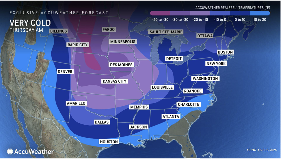
Blistering -45C North-Pole winds will battle Atlantic-driven storms into the weekend as millions face power outages, travel chaos and lethal frost-bite winds.
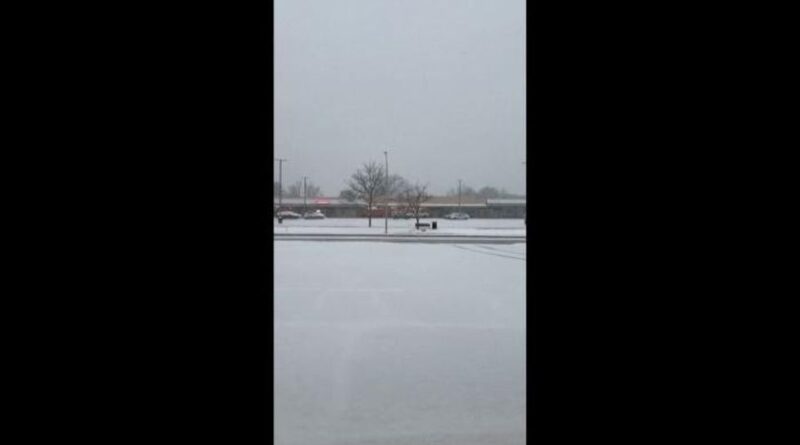
Freezing conditions will stretch as far south as Texas as snow and ice turn swaths of America into an ‘absolute mess’.
The late-cold snap coming at the start of the US tornado season has sparked warnings clashing air masses will whip up columns of churning snow.
Jim Dale, US meteorologist for British Weather Services, said: “With these storms, tornadoes are possible, and this is going to be more of a risk as we go towards the weekend.
“We are going into the start of tornado season, which is early spring, as the country is hit by severe cold weather.
“Colliding air masses will also bring the risk of thunderstorms where extreme cold meets milder air to the south.
“These cold fronts will continue to come in through the week as strong frontal systems come in from the Gulf of Mexico.”
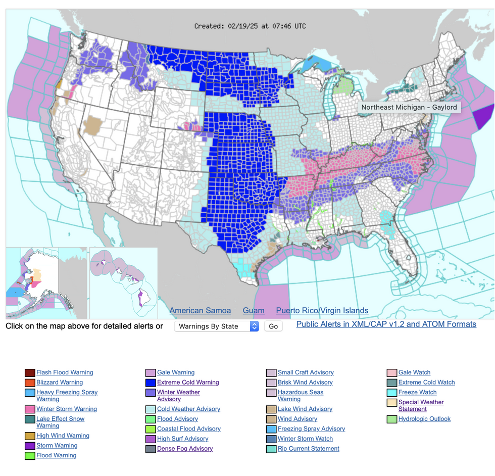
The US National Weather Service (NOAA) warned wind-chills of minus 60F, heavy snow and ice will persist through the week.
‘Dangerous’ cold winds will push further south as heavy snow piles into feet-deep drifts, it warned.
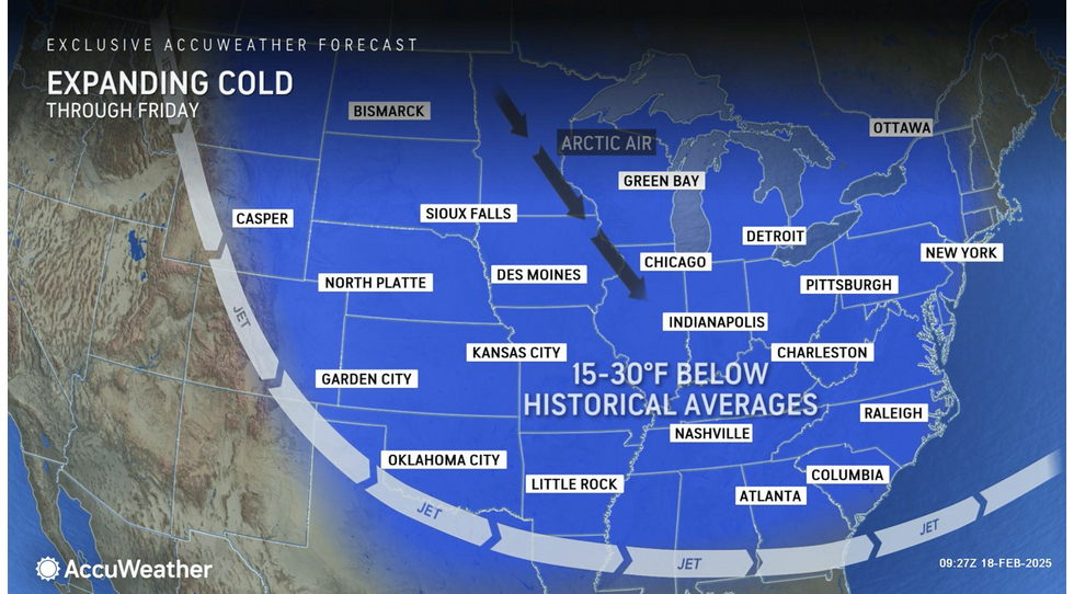
A spokesman said: “A large pool of Arctic air continues to advance farther south into the mid-section of the country.
LATEST DEVELOPMENTS:
- Monster storms ‘slicing through’ will drag record-breaking blizzards as far south as the Gulf Coast
- US weather: -50C ‘Arctic surge’ to bring ‘life-threatening’ whiteout
- ‘Second winter’ to batter millions as three major storms will see temperatures plunge to -42C
“Record cold temperatures and dangerously cold wind chills will spill further southward into the Plains with below-average temperatures spanning much of the East.
“By early Thursday, the next Pacific storm system enters the Northwest with high-elevation snow and high winds possible with this area of low pressure.
“The Storm Prediction Centre has a Marginal Risk for severe thunderstorms.”
Another foot of snow is forecast in the worst-hit areas before the weekend with freezing rain and ice threatening widespread power outages.
Even as far south as Texas, Oklahoma and Arkansas, temperatures will plummet 20 degrees below the seasonal average.
The record cold snap, driven by a huge high-pressure system sinking through Canada from the Arctic will bring the coldest spell of winter so far.
AccuWeather meteorologist Bernie Rayno said: “Much of Virginia and North Carolina are going to be an absolute mess with snow and dangerous ice.
“This winter storm will continue to push east through the Ohio Valley and into the mid-Atlantic from Wednesday and Thursday.
“Freezing rain, ice, and a wintry mix are expected along the southern edge of the storm from northern Texas to the Carolinas.”
Freezing Americans may heave a sigh of relief with the intense storms to ‘wind down’ after the weekend.
However, heavy rain sweeping in from the Pacific and melting will bring the added misery of flooding.
And another burst of freezing Arctic winds about to sweep eastern states will push thermometers around 30F below average.
AccuWeather senior director of forecasting operations Dan DePodwin said: “Freezing rain and wet spots freezing over can turn streets and sidewalks into a slippery sheet of ice. Driving and even walking on these icy conditions can be dangerous.
“A separate wintry blast will bring a coating to an inch or two of snow across parts of the Great Lakes, Ohio Valley and interior Northeast through Thursday, and blowing snow is possible.”