
US weather: Mega-freeze ends with 90F heatwave but airmass battle brings storm misery to millions
America’s late mega-freeze will thaw to a 90F summer blast as Arctic temperatures make way for record heat.
But battling Polar and tropical airmasses spell storm misery amid warnings for torrential downpours and flooding.
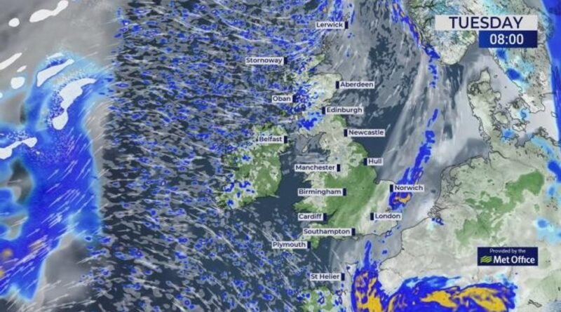
In the firing line are the Midwest and northeast where further snow will hit the far north while the south takes cover for tornadoes.
However, a plume of tropical warmth floating up from the Gulf of Mexico will for many kick-start summer.
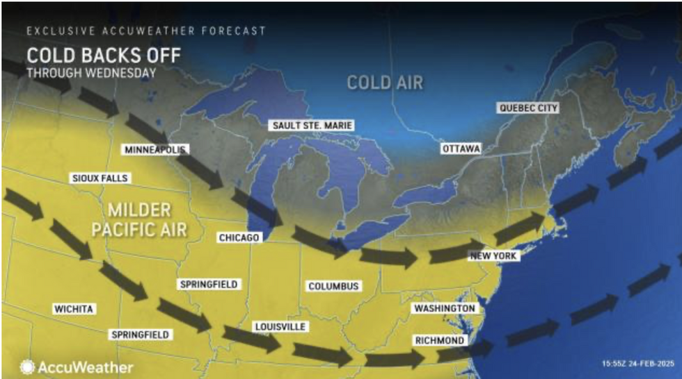
AccuWeather meteorologist Courtney Travis said: “Rising temperatures will make it feel like the East is finally climbing out of the depths of winter.
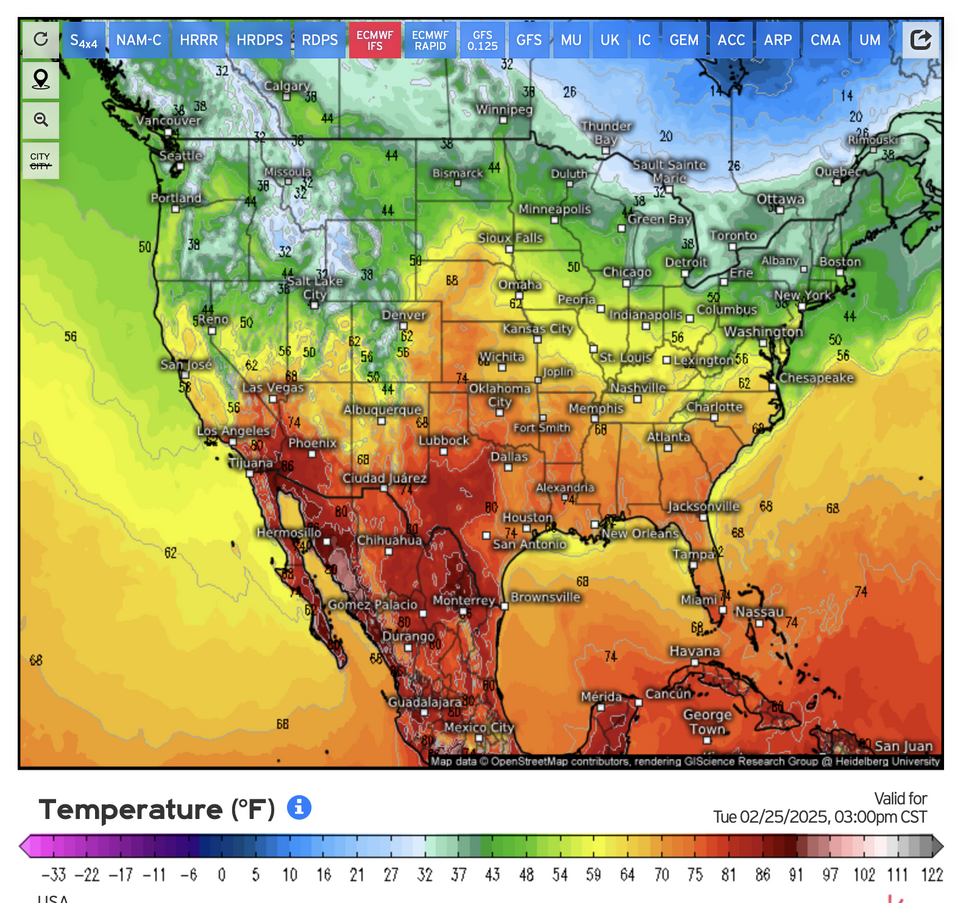
“Temperatures in cities like Chicago, Pittsburgh and New York are forecast into midweek to soar at least 10F degrees above the historical average.
“For most places, the coldest air will hold off until the weekend, although high temperatures are still forecast to be near the historical average for late February and early March.”
The National Weather Service (NOAA) predicts highs of 90F across desert states, while surrounding regions simmer into the 70FS.
While the change in weather will trigger storms, above-average temperatures will hold out through the week.
LATEST DEVELOPMENTS:
- Britain to be bashed by westerly winds as Arctic cold U-turns into milder temperatures
- US weather: Warning issued over risk of avalanches and mudslides after storm barrage
- Met Office issues rare amber warning as Britain to be lashed with 16hrs of rain
In parts of the country which have seen little rain over the past fortnight, hot dry conditions will bring a risk of wildfires.
A NOAA spokesman said: “Most of the country will see a period of mild conditions through the rest of this week, with highs upwards of 10F to 20F above average in many places.
“The National Weather Service has issued a Red Flag Warning for wind and low relative humidity.
“A combination of strong winds, low relative humidity, and warm temperatures can contribute to extreme fire behaviour.”
The big thaw will also trigger the risk of storms as hot and cold air masses collide triggering atmospheric volatility.
Arctic air remaining over the Great Lakes and eastern states will bring the risk of further snowfall.
Gusts of 35mph will drive snow into the northeast with travel disruption warned for the weekend.
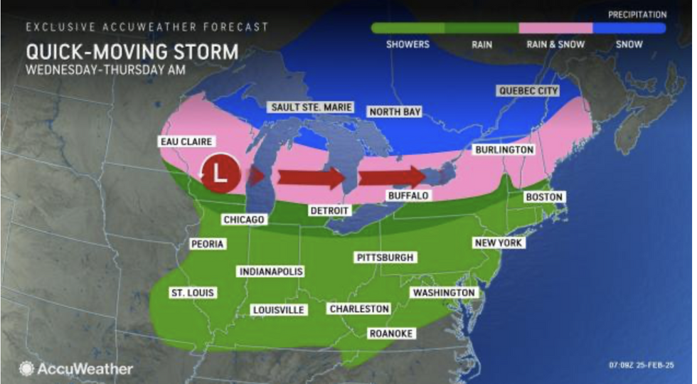
Weather Channel meteorologist Jennifer Gray said: “Several systems are going to track across the Great Lakes and the northeast through the week where we could see rain and even some snow for the extreme northern tier of the country.
“A more widespread system is going to pull through later in the week bringing rain and even snow to extreme northern sections.
“We could see snow for extreme northern sections of New England, however, windy conditions across the Northeast and New England throughout the week could bring some problems.”
Temperatures across southern and eastern regions are forecast to creep upwards through the end of the month.
Travis said: “Springlike warmth has already filtered into the eastern half of the country, bringing an end to the frigid conditions.
“Dry weather accompanied most of the warmth Monday before wet weather pops up around the Ohio Valley and Northeast Tuesday.
“However, the wet weather will not do much to taint the upcoming warmup.”