UK weather: Britain to undergo ‘dramatic change’ in coming days as cold snap ends
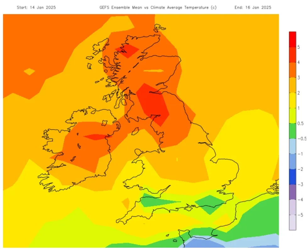
Britain is about to undergo a “dramatic change” in the weather, as the cold snap ends.
A substantial temperature swing hit Scotland’s Highlands, with readings soaring from -18.9C at the weekend to 11C by Monday morning.
The rapid warming, accompanied by strong southwesterly winds, caused deep snow across Scotland to disappear at an alarming rate.
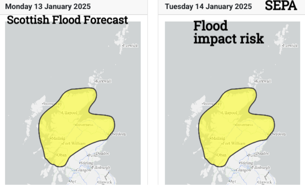
In a complete transformation from the frigid conditions that gripped the region just days ago, the sudden thawing raised concerns about potential flooding as snow melted rapidly across northern areas.

A stark weather divide has emerged across the UK, with frontal rain and blustery conditions sweeping across Northern Ireland and Scotland.
Southern Britain remains under the influence of cold high pressure, bringing more settled but murky conditions.
The high pressure system is expected to stay near southern areas as weather fronts move southward and weaken.
Light winds persist in the southeast, while the far northwest continues to experience blustery conditions.
According to the NetWeather forecast: “The middle of the week looks quiet with a risk of fog for England and Wales, even still a touch of frost for a few spots in southern or southwest England staying close to the cold air over mainland Europe.
“The stirring winds in the far north will continue at times reaching gale force for the Western Isles as rain wavers by.
“Overall the trend is for a quieter, less cold week ahead with mild conditions in the far north and west.
“A dramatic change away from the cold and wintry start to January. There will be fog to watch out for.”
LATEST DEVELOPMENTS:
- US weather: ‘Devil winds’ to push LA fire threat level beyond ‘critical’
- UK weather: Britain to make dramatic U-turn as freezing blast gives way to triple threat
- Grooming gangs survivor gives shocking account of ‘normalised’ sexual abuse: ‘I was isolated’

The Scottish Environment Protection Agency (SEPA) warned: “Flooding from rivers and surface water is likely on Monday and Tuesday across the north of the country. This is due to snow melt and outbreaks of rain.”
The agency added that “in some areas, river flooding is likely to persist into Wednesday as rivers continue to respond to the melt”.
The warning comes as two weather fronts move in from the Atlantic, affecting the northwestern half of the UK.
Through this week, much of the UK will experience predominantly dry weather, though the Western Isles and Northwest Highlands will face frequent weather front activity.

Monday was the wettest day, particularly affecting Cumbria, Lancashire, the Pennines and Anglesey into the evening.
The cold front’s impact will be accompanied by blustery southwestern winds bringing milder air.
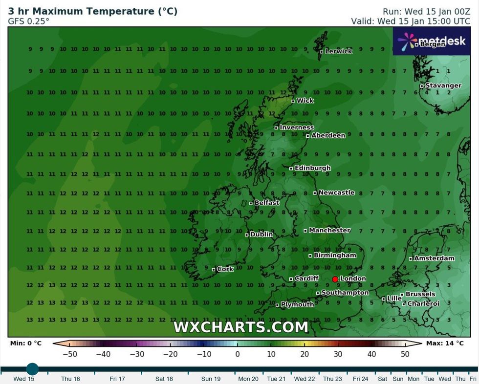
Temperatures across the UK are expected to reach between 7 to 11C, marking a notably mild period following the wintry start to January.
Southern and southwestern England may experience patchy frost, with temperatures dipping close to zero.
There is a risk of fog developing across England and Wales by mid-week, particularly in areas staying close to the cold air over mainland Europe.
The Western Isles could face gale-force winds at times, though the overall trend points toward quieter, less cold conditions nationwide.

