US weather: Americans warned over risk of snow as cold plunge spreads westwards
Storms driven by clashing hot and cold air masses are ramping up to threaten a widespread autumn ‘shock’.
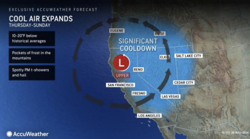
A cold plunge will spread westwards this weekend pushing thermometers in parts to freezing with even the risk of snow.
Extreme heat will hold its grip further south as tropical heat brings record temperatures to desert states.
Cold weather swept eastwards will spread to the Pacific coast this weekend bringing the first widespread chill of the year.
AccuWeather meteorologist Alex Sosnowski said: “A dramatic cooldown later this week may be a shock to millions of people in the western United States following relentless hot weather this summer.
“The chill will follow a storm that brought some cool air, clouds, showers and thunderstorms to part of the Northwest last weekend.
“This new storm will usher in unseasonably cool conditions from Thursday to Saturday in much of California, Oregon, Nevada, and parts of Idaho, Utah and Washington, and temperatures will be more on par with October, running 10F to 20F below the historical average for late August.”
US LATEST:
An Establishment LOVE-IN as Hollywood joins top Democrats for Tim Walz addressRFK Jr set to make major address to Americans as he’s tipped to ‘join forces with Donald Trump’Hulk Hogan jokes about ‘body slamming’ Kamala Harris as he questions her racial identity
Temperatures in parts of California will nosedive around 20F through the coming days.
In Nevada, the mercury will dip to below 100F for the first time in almost four months, experts say.
Cool air hitting the ground after months of extreme heat will set off a spate of thunderstorms.
Lightning strikes threaten wildfires in parts of the country left parched after weeks of hot, dry weather.
Sosnowski said: “Some of the storms could be locally heavy to severe. Where little rain falls, lightning strikes could ignite new wildfires, even with the cool conditions and higher humidity levels.
“A bit of snow is also in the offing for the highest elevations of the central and northern Sierra Nevada from Friday night to Saturday morning.”
Hot air pumping out of the Gulf of Mexico will keep the lid on the heat across the far south of the US.
Torrential rain and gusty winds threaten swaths of the country where hot and cold air lock horns.
Jim Dale, US correspondent for British Weather Services, said: “Where the two air masses meet will bring a risk of storms, and here there could be some flash flooding.
“Heat is still coming out of the Gulf of Mexico, and temperatures will remain high across southern states.
“Some of these storms could be thundery, and there will be a continued risk of wildfires where the ground is still dry after the summer heat.”
The US National Weather Service (NOAA) has extreme heat warnings in force across the south and separate wildfire warnings in Wyoming.
Choking smoke spewed out by sporadic blazes will bring the risk of poor air quality in parts, it added.
A spokesman said: “Combined with the oppressive humidity, daily maximum heat indices up to 110F will be possible.
“This will create a dangerous situation for some groups, particularly anyone spending large amounts of time outdoors.
“Slow-moving but intense rainfall-producing thunderstorms are possible across portions of Arizona, Utah, Colorado, and New Mexico.”

